

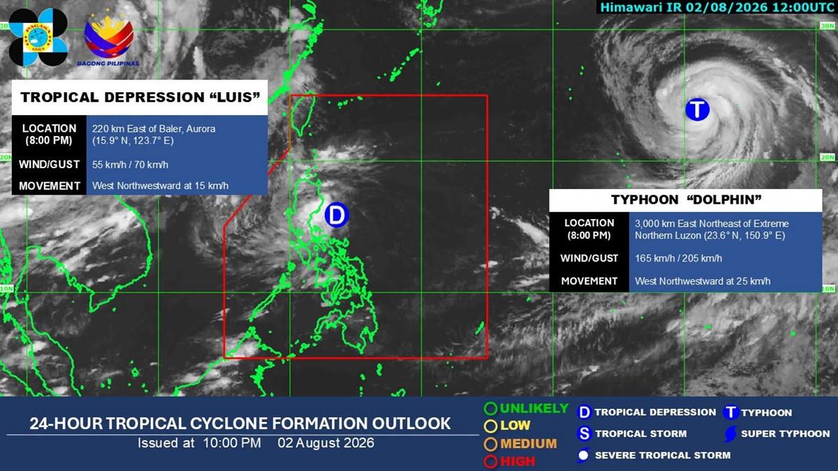
Tropical Depression Luis maintains its strength as it moves west-northwest over the sea east of Aurora, the state weather bureau PAGASA said in its 11 p.m. bulletin Sunday.
As of 10 p.m., Luis was estimated at 200 km east of Baler, Aurora, with maximum sustained winds of 55 kph and gusts up to 70 kph.

ADVERTISEMENT
Wind Signal No. 1 was raised in the following parts of Luzon:
• Southern portion of Cagayan (Enrile, Tuguegarao City, Peñablanca)
• Isabela
• Quirino
• Northern portion of Aurora (Dinalungan, Casiguran, Dilasag, Dipaculao, Baler)
• Polillo Islands
• Northern portion of Camarines Norte (Daet, Talisay, Paracale, Jose Panganiban, Capalonga, Vinzons)
Minimal to minor impacts from strong winds are expected within any of the areas under Wind Signal No. 1.
Heavy rainfall outlook
The heavy rainfall outlook forecasts 50-100 mm of rain due to Luis over the provinces of La Union, Pangasinan, Benguet, Cagayan, Isabela, Nueva Vizcaya, Quirino, Zambales, Tarlac, Nueva Ecija, Bulacan, Aurora, and Quezon from Sunday to Monday evening.
It also forecasts the following amounts from Monday evening to Tuesday evening due to Luis:
100-200 mm: Zambales and Pangasinan
50-100 mm: Ilocos Sur, La Union, Benguet, Isabela, Nueva Vizcaya, Quirino, Aurora, Nueva Ecija, Bulacan, Tarlac, Pampanga, Bataan, Metro Manila, Cavite, Batangas, and Rizal
It also forecasts 50-100 mm of rain in Occidental Mindoro from Monday evening to Tuesday evening due to the Southwest Monsoon.
PAGASA said Tropical Depression Luis is expected to intensify into a tropical storm in the next 12 hours, while moving over the sea east of Central Luzon.
Classes for Monday have been suspended in several areas due to the storm.
Meanwhile, Typhoon Dolphin is being monitored within PAGASA’s Tropical Cyclone Information Domain (TCID). — Lyjah Tiffany Bonzo/BM, GMA News