Tropical Weather Outlook – NWS National Hurricane Center, Miami FL, 8:00 AM EDT, Wed, Sep 11, 2024
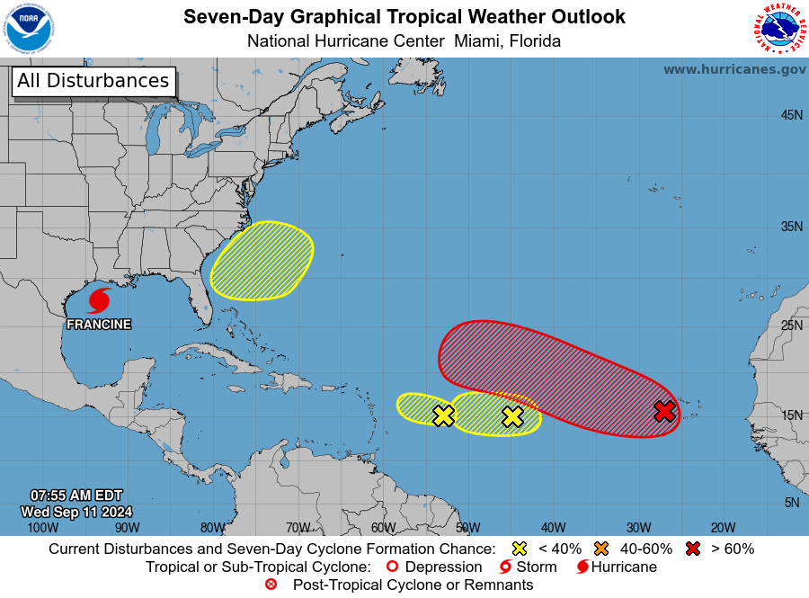
Eastern and Central Tropical Atlantic (AL93): A tropical wave a few hundred miles west-southwest of the Cabo Verde Islands is becoming more organized, with a tropical depression likely to form in the coming days as it moves west-northwest at 10 to 15 mph. Formation chances are 50% over the next 48 hours and 90% over the next week.
Central Tropical Atlantic (AL92): An area of low pressure in the central tropical Atlantic is producing some disorganized showers and thunderstorms. Conditions are marginal for development over the next couple of days as it moves westward at 5 to 10 mph, but stronger upper-level winds expected Thursday may end its development chances. Formation chances are 30% through both 48 hours and 7 days.
East of the Leeward Islands: A small, low-pressure system several hundred miles east of the Leeward Islands is creating disorganized showers and thunderstorms. Dry air is likely to limit development over the next few days, with very low chances of further development by the weekend. Formation chances are 10% through both 48 hours and 7 days.
Offshore the Southeastern U.S.: In a few days, a non-tropical low pressure could form off the southeastern U.S. coast. Some subtropical or tropical development is possible next week as it drifts over the Gulf Stream or slowly northward. Formation chances are near 0% through 48 hours and 20% through 7 days.
Forecaster Papin


